Open Data for Developing Economies Case Studies

Jamaica’s Interactive Community Mapping

Open Data and Crowdsourcing for Tourism

by Andrew Young and Stefaan Verhulst

Impacteconomic

Sectorbusiness

LocationJamaica

Read Time

Brief View 9 MINS

Full Story 28 MINS

Like much of the Caribbean, the Jamaican economy is heavily dependent on the health of its tourism sector. Influenced by the rise of all-inclusive resorts, which create a general disincentive for tourists to stray far from a few highly-trafficked areas, tourists rarely experience much of Jamaica’s unique culture, and the economic benefits of tourism tend to be highly concentrated. In order to demonstrate the potential for increasing tourism (and the spread of its economic benefits), a community mapping project launched in November 2015 sought to combine open government data with crowdsourced mapping data to enable a more participatory development of the tourism sector. Built around open tourism data and the efforts of government agencies, civil society organizations, developers, and a group of motivated community mappers, the initiative is providing early insight into how data and collective intelligence can impact an industry that in many ways represents the lifeblood of the country.

Read More

Problem Focus/Country Context

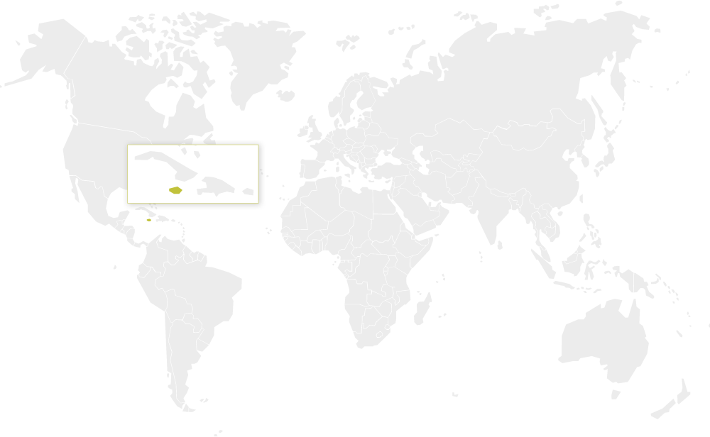
Jamaica is a small island nation located about 600 miles from Miami and 100 miles south of Cuba. It is a member of the British Commonwealth of Nations and has close economic ties to the United States. It gained its independence in 1962 during an era of global decolonization and still grapples with the political, economic, and social legacies left by colonization.

The Caribbean region continues to be a hotbed of tourism activity. From 2005 to 2013, tourist arrivals to the Caribbean grew by 5.4 percent, outpacing the average global growth rate (4.7 percent). In 2014, the Caribbean as a whole received 26.3 million trips (breaking the previous record set in 2013 by 1.3 million). This level of tourism activity represented 2.3 percent of total global tourism arrivals.3 The Caribbean is also the number one cruise destination in the world.

Jamaica’s economy, similar to that of the Caribbean as a whole, is heavily reliant on service industries, which, according to some estimates, makes up as much as 70 percent of the nation’s GDP.4 Most of those services are related to tourism, one of the nation’s economic strengths. According to the Jamaica Observer, more than 3 million tourists visited the island in 2014, including those from cruise ships.5 Jamaica has experienced year-to-year growth over recent years—a 3.6 percent increase from 2013-2014 in stopover visitors and 12.5 percent increase in cruise visitors over the same period, continuing a trend observable since 2007.

While the tourism sector is seemingly healthy and evolving rapidly, the need for a more citizen-inclusive model for tourism development is widely recognized, as is the need for a more intelligent, centralized system for collecting and managing tourism data.6

The All-Inclusive Tourism Model

Over the past few decades, tourism in the Caribbean has been influenced by the rise of all-inclusive tourism offerings. The paradigmatic example of this model is a central beachside resort that offers, among other services, all-you-can-eat and drink packages for visitors, ensuring that consumers do not have to leave the grounds of the resort for any reason. These resorts tend to cater to preconceived notions held by travelers about Jamaican culture and life—relatively few visitors, for instance, ever explored Kingston beyond the sights seen from a one-day tour bus. The Trench Town Development Association, a grassroots initiative, has aimed to help visitors experience the famous Trench Town neighborhood of Kingston – the home of Reggae icon Bob Marley, and the acknowledged birthplace of rocksteady and reggae music – by offering a local tour guide, featuring “a museum, a music studio, and a school, as well as interaction with artists, craftspeople, and community elders.”7 Though still wary of inner-city Kingston violence, visitors are somewhat more likely today than ever before to interact with local communities that have proven to be resilient in the face of both violence and poverty

Christopher Whyms-Stone of the Trench Town Development Association argues that while there are many benefits to the all-inclusive tourism model, “it is lazy for a country to say it is going to push this model because crime in the country is too high so we can’t let the visitors go outside. … No wonder we still have not solved crime in Jamaica…. That is the strongest word I will use—lazy. That is the easy way out.”8 Whyms-Stone is careful to point out that the all-inclusive model has very real benefits for Jamaica—including the fact that many Jamaicans are employed by such resorts, and that many visitors to the Trench Town Development Association are based at all-inclusive resorts for much of their stay. Rather than demonizing the all-inclusive approach, he argues that tourists and Jamaican citizens would benefit from additional efforts to advance community-oriented tourism initiatives rather than relying solely on the all-inclusive model.

Tourism and Information

The centrality of tourism to the local economy presents various challenges for policymakers and business owners in Jamaica and across the Caribbean, particularly due to the volatility and unreliability of tourism arrivals. Recently, the need for information has become more apparent, for instance to help Jamaican tourism authorities plan their offerings as well as for tourists themselves to better understand the possibilities on offer (especially the possibilities beyond the all-inclusive resort).

Better information is seen as key to opening up new tourist activities and areas. For instance, a tourist may be more likely to engage in a community-based tour of a Kingston neighborhood if there is easily-accessible information about the unique culture, history, and people of the region. Similarly, a local entrepreneur will make more informed decisions if he/she has access to data detailing the interests and activities of tourists visiting his/her region. The Inter-American Development Bank notes “a general absence of data for [tourism] benchmarking and strategic planning in the region” and argues that “the effective use of Big Data has the potential to transform the tourism sector, delivering a new wave of productivity growth and consumer surplus.” As such, it recommends the development of “public policy promoting positive externalities such as knowledge sharing and addressing coordination failures so that the private sector is encouraged to innovate and upgrade, aiming for collective efficiency.”9

Open Data in Jamaica

Open data could be critical in generating the necessary information. A recent study conducted by the Caribbean Policy Research Institute (CaPRI) concluded that an open data initiative in Jamaica could improve productivity in the tourism industry by 10 percent. Jamaica is well-aware of this potential (and of the need for better information) and has signaled its openness to open data policies and frameworks.10 In 2014, the Jamaican government partnered with the World Bank to develop a framework for “open data development as a job creation and entrepreneurship option.”11 It is the opinion of the World Bank that Jamaica has “many of the essential prerequisites needed to support a successful program” as well as “the region’s most vibrant community of people who could use” the data.12

Maurice McNaughton, the Director of the Caribbean Open Institute (COI), a coalition promoting open development, argues that while the Caribbean as a whole was “late to the open data, open government party,” the Jamaican open data space is noteworthy in a number of ways. For instance, he notes that, “unlike many of the more celebrated instances which start with governments publishing a lot of data and then trying to simulate activity around that, we’ve actually started from a demand side perspective in a number of key sectors and have been working our way back towards identifying the most impactful data sources.” He continues: “on the demand side, the user capacity and interest in open data is quite high. In fact, it was rated the highest of the 7 pillars in terms of the World Bank’s overall readiness assessment.”13,14

The belief that the Caribbean and Jamaican tourism industry can benefit from increased open data activity is resulting in greater availability of information.15

Interactive Community Mapping (ICM)

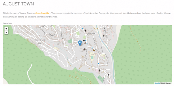
http://icm.msbm-uwi.org/content/august-town

A community map is a map produced by citizens of residents of a particular area. It includes local knowledge and expertise, and is seen by some as a more democratic and people-centric response to traditional cartography.16 17 Changes to traditional cartography have been driven in recent years by two main forces: 1) the emergence of critical geographers who have “illuminated the map’s crucial and tendentious role in shaping the world” and its relationship to power,18 and 2) the emergence of freely-accessible data and accessible mapping technologies.”19 Most community mapping projects are found in developing country contexts.20

There are several advantages to interactive community maps. Like many community information projects, they rely fundamentally on open data. Chief among their advantages are the facts that they tend to be drawn quicker, are more dynamic, cost less to produce, and provide more granular information.21 Successful map projects must carefully consider the particularities of a community being mapped (as well as that community’s access to the resulting map, particularly in poorer, marginalized neighborhoods); the existence of civil society actors who can utilize the maps in public campaigns and activist pressure; and the government officials who service the community being mapped (taking care to include their priorities and needs in the mapping project).22

There are several examples of ICMs in developing country contexts. ICM efforts have been used for community-driven advocacy (e.g., in Nairobi23), and in responses to public health crises (Sierra Leone24) or natural and other disasters (e.g., Gulf of Mexico,25 Haiti26). Jennifer Shkabatur, a scholar at the Interdisciplinary Center Herzliya, an Israeli research university, notes that the prevalence of ICMs in fields like disaster response is not surprising. ICM efforts are often successful in such situations because “the incentives are there, you do not have to encourage people. People know they should be there.”27 ICM in less urgent situations, however, are much harder to sustain without similarly clear incentives for participation.

Key Actors

Key Data Providers

Government of Colombia

Jamaica’s tourism industry is governed by the Ministry of Tourism, which maintains data on the number of visitors who enter the nation and where those visitors stay. Local mappers are also providing data in a crowdsourced manner to supplement official data sources with on-the-ground information.

Key Data Users and Intermediaries

The Caribbean Open Institute (COI) was the lead actor in the ICM effort in August Town. The COI is a “regional coalition of individuals and organizations that promotes open development approaches to inclusion, participation and innovation within the Caribbean, using open data as a catalyst.” Its focus areas include spurring “awareness, advocacy and engagement with public sector stakeholders on Open Government and Open Data” and catalyzing “regional capacity building in a core set of technology platforms, tools and standards that are commonly used across the Open Data universe.”28 COI also plays a key role in regional efforts, like the Developing the Caribbean open data conference and Codesprint.

COI’s Maurice McNaughton notes that, “we have been very deliberate about picking sectors that are high impact for the Caribbean.”29 As a result, COI’s initiatives focus on the agriculture, tourism, and marine protected areas sectors.

Key Beneficiaries

The ICM effort is meant to benefit a wide range of actors, including tourists themselves, stakeholders in the local tourism industry, and the country at large, which stands to gain from the economic benefits of a more widely dispersed tourism industry. In a paper describing the initial pilot project studied here, Michelle McLeod, Maurice McNaughton, the drivers of the initiative, note beneficiaries such as, community residents; tourism businesses (to the end of improving the “technology and data literacy skills of tourism businesses to develop innovative tourism products and services); the UWI Mona Source hosting service (which stands to “become a hub for open data and ICM activities”); the Social Development Commission (a government agency that will play a key role in scaling tourism ICM efforts and gain access to new mapping artefacts); and tourism app developers, who stand to gain access to useful new maps and, potentially, new collaboration opportunities with other stakeholders in the space.30

Read More

As the potential for crowdsourced mapping efforts (often but not always supplemented with open government datasets) continues to grow in recognition, it is seen as an important enabler of community tourism, which is a “key component of Jamaica’s Tourism master plan and efforts to diversify the Tourism product.”31

In 2015, Maurice McNaughton and Michelle McLeod of the University of the West Indies and Caribbean Open Institute (COI) began a tourism-focused ICM initiative. The project was aimed at leveraging open data and a crowdsourced ICM effort to create new tourism-focused mapping artefacts and build new mapping skills for community members. The initiative was developed to highlight “heritage, culture, ecology, and visitor-community interaction” in a way that enabled the community to generate “its own data and its own intelligence and based on its own indigenous knowledge.”32

As McNaughton put it in a paper, underlying this initiative was the belief that:

[C]ombining the Internet and new low-cost, interactive, map-based technologies with official Open Government data and indigenous content creates the opportunity for the active engagement of community members in the planning, development and increased visibility of the community tourism product, as well as enhances the interactions between the community, the tourism agencies, and other service providers within the sector; i.e., transportation, larger hotel chains, tour operators, and prospective tourists.33

To set the stage for the ICM effort, a team from COI conducted a detailed sector study, looking at the main data sets being put to use in five countries that had important tourism sectors. This effort sought to gain a greater grasp of both the supply and demand sides of the tourism open data ecosystem, the current and potential users of such data and where most of these datasets existed on the open-closed spectrum. The team found that while in some cases data are not fully open, there was “quite a lot of activity both in terms of the demand and supply side in the tourism sector” and available datasets were “being used to make critical strategic decisions in the sector.”34 For example, in an interview, McLeod pointed to Barbados’ use of tourist arrival data to enable targeted outreach to new airlines that could benefit from servicing the island and to adjust airline policies to enable growth. She argues that the Barbados case is only one example of how the “openness of the tourism data is critical for timely decision making and strategic adjustments in the sector.”35

Following these initial research efforts, the ICM pilot project advanced by McLeod and McNaughton began in earnest during an initial meeting in June 2016 with partners from the Centre for Tourism and Policy Research; Mona Social Services, a social and economic development NGO; and The Source, a local resource hub. The goal was to identify potential mappers to take part in the project. The initial meeting was followed by an “intensive 5-day workshop” wherein volunteer mappers were trained on geodata capabilities and, in particular, the use of the OpenStreetMap platform. Upon completion of the workshop, the participating mappers were placed into teams and assigned to different grid areas across August Town, a neighborhood in Kingston. Over a four-week period, the participants mapped landmarks and areas of interest, tour routes and bus stops. They also collected pictures and video for inclusion in mapping artefacts made available to the public.36

The ICM initiative was developed with the goal of achieving four main aims. First, it set out to map points of interest and community assets around Kingston and St. Andrew. Second, it sought to provide useful data and information to stakeholders active in the Jamaican tourism sector. Third, it sought to lay the groundwork for future community mapping and community-oriented tourism activities. Finally, the effort sought to provide new skills and entrepreneurial opportunities for community members participating in the mapping initiative.37 The first ouput of the initiative was a Virtual August Town tour companion app providing data-driven and community-oriented maps and suggestions for making the most out of visits to the area.

A follow-on initiative was organized shortly afterward, bringing together a number of community leaders in addition to the strategic partners and mappers. This second focus group yielded a “Tourism Related Wish List” that helped to better target the efforts of the community mappers. Some of the items on the wish list included, food festivals, youth sports facilities and local community tour guides.38 The two initial pilot mapping projects yielded a number of digital maps and tourist routes described in more detail below.

Demand and Supply of Data type(s) and sources

According to the Open Knowledge Foundation’s Caribbean census site, a number of open data sets related to tourism are available (even if some of the data is not truly “open” by the strictest definition). Some of these datasets include: tourism arrivals (“aggregate data about tourist stop-over visits, derived from anonymized landing card data”); tourism service providers (“listing of registered service providers including Tour Operators, Transportation / Taxi service, Car rental, Adventure & Entertainment providers”); and tourism assets (“list of registered tourism assets including large/small hotel properties, attractions, craft markets”).39 These datasets represent the core public information on the sector, and provided a foundation for the ICM effort, helping to target mappers’ focus toward areas of particular interest.

Funding

COI has five central partners and funders: the International Development Research Center (IDRC), Mona School of Business & Management, SlashRoots, Fundacion Taiguey and Open Data for Development Network. Specifically, the ICM effort was one of four strategic sector initiatives being implemented as part of the Harnessing Open Data to Achieve Development Results in Latin America and the Caribbean program funded by IDRC.40

Open data use

The ICM effort leveraged the open datasets available listed on the Open Knowledge portal to target mapping efforts and provide the backbone for the crowdsourcing effort. The newly generated, crowdsourced, open data was created through the OpenStreetMap platform, available for access and reuse by anyone, including other tourism-focused actors in Jamaica, demonstrating the value of supplementing open data with crowdsourced – and ensuring the crowdsourced data itself is made open.41

Read More

The Jamaican Interactive Community Mapping initiative is still in its infancy, and major on-the-ground impacts have not yet been achieved. The initiative has, however, achieved some early wins – in the form of new deliverables produced, skills provided for community members, and inspiration for similar initiatives in the region aimed at leveraging open and crowdsourced data to benefit the public good.

Encouraging More Diverse, Community-Oriented Tourism

One of the initial outputs of the project, demonstrating the utility and potential of interactive community mapping data, was the design of a virtual August Town tour companion app, which was launched at the 178th anniversary of the August Town community.42 Some of the key points of interest include the Judgement Yard, the Bedward Church Ruins, the Berry Spring and the culminating food- and craft-focused Artisans’ Village.43 Many other buildings and points of interest are interspersed along the path.44

This new community-produced route for tourists stands to be a win-win situation, where tourists are exposed to points of interest that they would be unlikely to experience if they stayed on-site at their all-inclusive hotels (or, indeed, participated in a traditional bus tour), and the local community is exposed to a larger population, with the map helping “to create more business activity in the community.”45

Skill-Building for Mappers

From the start, McNaughton and McLeod saw the digital maps as only one of the intended outcomes of the project. McNaughton describes the second objective as “more of a process outcome,” specifically: “How do we build capacity and a capability for the community to begin to create its own narrative and its story?”46 As such, the ICM effort was aimed at seeding “the ability of the community to generate its own content and to anchor new tourism products and services around that open map content.”47 Such a focus is common among ICM efforts. Shkabatur notes that “the engagement itself, the skills and the tools that community members gain from the mapping exercise” are often as beneficial as the fruits of their efforts.48 For McLeod, “It’s all about community resilience.”49

There are several indications that such efforts in Jamaica have borne fruit. McNaughton found that the mappers “developed an energy and enthusiasm and entrepreneurial spirit” as a result of their new-found skills. For example, many mappers have taken it upon themselves to create maps of nature tours, hiking trails and other potential tourist attractions. This entrepreneurial spirit has not gone unnoticed. Other communities in Jamaica with significant Tourism interests such as the Treasure Beach Cluster are keen to explore similar approaches to enhancing their community tourism product.50 Community leaders, like the President of the Community Development Council have recognized the value and potential of such efforts, and are in the early stages of developing and implementing new opportunities for mappers to leverage their skills, with the goal of further “showcasing the heritage, the music, the art, and just that general community spirit.”51

Scaling and Replication Across the Region

Maurice McNaughton found that “one of the major emerging insights” from the effort was the fact that the “digital asset and its openness…can be pivoted in many different directions.”52 For example, community mappers are exploring opportunities with local government agencies to support a number of initiatives, including efforts to promote school safety, improve resilience and response to Zika, and to further increase the visibility of Jamaica’s tourism offerings.53

Going forward, the COI team hopes to continue to replicate and expand on the initiative across regions and sectors, with a notable focus on education.54 Future efforts specifically related to tourism could include “spinoffs such as bed and breakfast [mapping] opportunities, and opportunities to even beautify the environment in the community.”55 Shkabatur argues that replication of ICM efforts are often quite easy in terms of technology, especially given the prevalence of OpenStreetMap, but sometimes experience challenges when there is a mismatch in social context or the strength of community groups and organizers.56 Given the ICM interest and buy-in among both organizers and participants in the Jamaican tourism effort, perhaps these issues will be less challenging than in other contexts.

Risks

As evidenced by the example of the Jamaican ICM effort and various other case studies included in this series, open data holds tremendous potential for positive transformation. But, as we also see throughout this series, open data also poses certain risks. It is important to understand these risks in order to ensure that open data projects are implemented in a way that maximizes the potential upside and limits the downside.

Potential for Negative Publicity

While the ICM effort is premised on the belief that tourists and the Jamaican community both stand to benefit from increased interaction, the impetus for the rise of all-inclusive resorts remains a question. Poverty and crime issues are still present in Jamaica, and on top of the obvious human cost of any crime (violent or otherwise) befalling tourists using the ICM-generated artefacts, the potential negative publicity arising from encouraging tourists to venture off the beaten path could undermine these community tourism efforts.

Read More

Several important lessons with wider applicability emerge from this particular case study. These can broadly be categorized by considering the key enablers of the project, as well as the most important barriers or challenges to its success.

Enablers

Problem Definition and Context

Tourism is not one of the central areas of focus for open data initiatives in most parts of the developing or developed world. McNaughton notes, however, that while other countries are actively engaged in transportation, government budget, or agriculture open data efforts, “the Caribbean is seen as the most tourism-dependent region in the world. We thought it was important to look at tourism as one of the region’s key sectors and what the possibilities or the opportunities were for open data to make an impact…Context matters.”57

To refine and focus in on the areas of most potential impact, as described above, COI conducted detailed tourism open data and ICM scoping studies, which helped to target mapping efforts and data use. This clear, upfront problem focus also helped to identify gaps in existing open government datasets, and consider other avenues for filling those gaps. It was one of the keys to the project’s relative success.

Engaging the Press

Upon completion of the initial ICM effort, COI leveraged the press as a key intermediary in spreading the word about the fruits of the project. While many open data efforts—including some in this series of case studies—struggle with raising awareness, COI promoted both the output (i.e., the August Town tour) and the process (i.e., OpenStreetMap-enabled ICM) through the local press.58 Such an effort could help to ensure that the tourism artefacts, maps and datasets are used by those who stand to benefit the most from them. In addition, such efforts can also promote the use of open data and ICM more generally, potentially pushing forward the approaches in other areas.

Building Partnerships

Brokering partnerships with community groups, intermediaries, NGOs and government was seen as a key factor in allowing for the targeted matching of the supply and demand for data around Jamaican tourism.5960 COI is not only well-connected in the local Jamaican community, leading to more buy-in from government actors and volunteer mappers, but also to the global open data community, helping to enable knowledge transfer and collaboration with others doing similar work across the world.

Barriers

Resource Challenges

Given the relatively limited availability of open data, as described above, it is little surprise that the availability of resources at the data supply side represented the central challenge for the ICM effort. In reference to the supply side, McNaughton notes that, “I don’t think in the Caribbean we have the luxury of just opening up all data and making hundreds or thousands of data sets available and then seeing what happens. We don’t have the luxury of that scattershot approach as has characterized many open data initiatives.”61 So while this project could be advanced with relatively little funding (considering the volunteer nature of the mappers and the open source OpenStreetMap platform), resource constraints at the supply side often create barriers to efforts to leverage open data in the country.

To address these types of challenges, McNaughton notes that Jamaican open data efforts often must be “very targeted, starting from sector-specific challenges and opportunities that we perceive and then working from those back towards engaging in partnerships with the supply side to get the data that is relevant to those either problem- or opportunity-centered approaches.” 62 63

Institutional Culture Challenges

While resource constraints create major challenges, McNaughton believes that “perhaps a larger barrier that we have encountered in much of our work is a cultural barrier to sharing data.”64 While progress is being made—students no longer need to parse static government PDF documents to pull out relevant “open” data as they previously did—shifting the culture remains a slow process with fits and starts. The growing visibility of international open data assessments and shared policies are helping to push for meaningful culture change and institutional recognition of the value of machine-readable open data, and, as a result, the opening of more useful datasets.65 Important steps forward were taken in 2016 with the launch of Jamaica’s Open Data Portal (http://data.gov.jm/) and its entry into the Open Government Partnership.66

Supply-Side Awareness Building

As discussed above, the open data ecosystem in Jamaica is largely demand-driven. And while international readiness assessments like those conducted by the World Bank are helping to push forward the supply side, there is still relatively little awareness of the potential value of providing more open data to the public. McNaughton believes that making the case more effectively to government that the issues they face could help to bring more problem-solvers outside of government into the equation could help improve the supply of open data in the country. As it stands, there is little understanding of the types of problems that could be solved through open data, the benefit of allocating the time and resources necessary to make it available, and what open data can do to “enhance what we do in terms of growth and development in the region.”67

Read More

Due to the importance of tourism to the Jamaican economy, continued development and scaling of open data-driven tourism efforts is likely to continue. As Whyms-Stone of the Trench Town Development Association notes: “we are an island with not a lot of resources…Not a lot of minerals, we don’t got oil. But what we do have is a place like Trench Town, a place called Jamaica that people want to come to for whatever reason.”68

He continues that he “believes in tourism 100%...it is a source, an economy of revenue so your people can have a better quality of life, health, education, housing. And that is why I believe in tourism because it is necessary. People want to come here; we want people to come here. We need an economy, let’s make it work.”69

Current Status

The initial pilot ICM initiative has now concluded, but the insights and resources (including the tourism artefacts) it generated are being put to use in a number of ways. The project is now expanding and evolving across a number of sectors and regions, described more below.

Sustainability

Given the benefits provided to community mappers in terms of skills development, and the limited resources required for spurring an ICM effort, the continued expansion of the Jamaican tourism initiative seems promising. While there are challenges, as described above, especially around the availability of relevant open datasets, the public interest and availability of the open source OpenStreetMap platform bodes well for the sustainability of such efforts. As a cautionary note, it is worth mentioning that in other parts of the world, efforts to sustain ICM interest and engagement over a longer time period have proven difficult after the initial motivation for citizen participation (e.g., a natural disaster or the creation of a specific mapping artifact) became less urgent.70 The ICM Tourism Pilot in Jamaica has identified the many actors that need to collaborate in order to develop a vibrant, sustainable open data ecosystem in community tourism.71

Replicability

Replicability of the ICM effort across the Caribbean is promising, given the key insights and resources developed as part of the Jamaican effort. Given resource constraints, scaling innovations across the region often rely on the availability of “common resources and common approaches,” which this effort has provided.72 Regarding the replication of the tourism ICM effort, McNaughton notes, “We have packaged it. We have developed approaches and platforms and techniques and quite interesting workshop around mapping. We can easily replicate that in many other contexts so that everybody is not reinventing the wheel, which is a challenge that the Caribbean has had in traditional endeavors.”73

As McLeod notes, “Of course, we are divided by the sea and that is a barrier, but we want to be able to really replicate it across the islands and ensure that our region can benefit with the whole open data movement.”74

Read More

While the on-the-ground impacts of the Jamaican interactive community mapping effort are still largely aspirational, the initiative provides inspiration and important lessons regarding the use of open data and crowdsourcing to create new economic opportunity and improve social cohesion. Based on a clearly defined problem – i.e., the need for more information on the tourism sector in the country to benefit local stakeholders and tourists themselves – the project organizers were able to identify useful open data sets and fill gaps in the data with a community-oriented data collection effort. By both producing new artefacts to benefit the sector and providing community members with new mapping skills, the initiative stands to create an ongoing impact for those living in the region, as well as those vacationing there.

Read More

Reference

1 . Project conducted in collaboration with the Web Foundation, United States Agency for International Development (USAID), and the Mobile Solutions, Technical Assistance and Research (mSTAR) program at FHI 360.

2 Special thanks to Akash Kapur who provided crucial editorial support for this case study, and to the peer reviewers who provided input on a pre-published draft.

3 . Caribbean Tourism Organization, Caribbean Tourism Review, 2014, http://www.onecaribbean.org/wp-content/uploads/2014TourismReviewDocumentAmendedFEB11.pdf.

4 . Witherbee, Amy, “Jamaica,” Our World, Research Starters, January 2016, EBSCOhost (accessed September ٢١, ٢٠١٦).

5 . “Tourist Arrivals Increased by 3.6 % in 2014,” Jamaica Observer News, February 5, 2015, http://www.jamaicaobserver.com/news/Tourist-arrivals-increased-by-3-6---in-2014.

6 . Caribbean Tourism Organization, Caribbean Sustainable Tourism Policy Framework, http://www.onecaribbean.org/content/files/CbbnSustainableTourismPolicyFramework.pdf.

7 . Eveline Dürr and Jaffe Rivke, “Theorizing Slum Tourism: Performing, negotiating and transforming inequality,” European Review Of Latin American & Caribbean Studies, no. 93, pp. 113-123, October 2012.

8 . GovLab Interview with Christopher Whyms-Stone, Trench Town Development Association, September 29, 2016.

9 . Seggitur and CICtourGUNE, Compete Caribbean: Improving competitiveness in the Caribbean tourism sector through ICT-based innovations, InterAmerican Development Bank, 2014, http://competecaribbean.org/wp-content/uploads/2015/04/Improving-Competitiveness-in-the-Caribbean-Tourism-Sector-Through-ICT-Based-Innovations_September_v4_docx.pdf.

10 . Maurice McNaughton, “Open Government Data: A Catalyst for Jamaica’s Growth and Innovation Agenda,” Caribbean Policy Research Institute, October 2014, http://www.capricaribbean.com/documents/open-government-data-catalyst-jamaicas-growth-and-innovation-agenda.

11 . “World Bank to Assist Jamaica with Open Data Development,” Jamaica Observer News. December 09, 2014, http://www.jamaicaobserver.com/latestnews/World-Bank-to-assist-Jamaica-with-open-data-development.

12 . Jamaica Ministry of Science, Energy and Technology, “Jamaica Receives Favourable Open Data Assessment Report,” Ministry of Science, Energy, and Technology, http://mstem.gov.jm/?q=jamaica-receives-favourable-open-data-assessment-report.

13 . GovLab Interview with Maurice McNaughton, August 24, 2016.

14 . Jamaica Ministry of Science, Energy and Technology, “Jamaica Receives Favourable Open Data Assessment Report,” Ministry of Science, Energy, and Technology, http://mstem.gov.jm/?q=jamaica-receives-favourable-open-data-assessment-report.

15 . Gerard Best, “How Open Data Can Help Caribbean Development, Caribbean Journal, October 4, 2015, http://www.caribjournal.com/2015/10/04/how-open-data-can-help-caribbean-development/.

16 . Brenda Parker, “Constructing Community through Maps? Power and Praxis in Community Mapping,” Professional Geographer ٥٨, no. 4, 2006, pp. 470–84.

17 . John Pickles, A History of Spaces: Cartographic reason, mapping, and the geo-coded World, London: Routledge, 2004; Chris Perkins, “Community Mapping,” Cartographic Journal, 44, no. 2, 2007, pp. ١٢٧–٣٧; and Jennifer Shkabatur, “Closing the Feedback Loop: Can technology bridge the accountability gap?” Interactive Community Mapping: Between empowerment and effectiveness, The World Bank, May 2014, pp. 71-106.

18 . J.B. Harley, “Maps, Knowledge, and Power,” in Denis E. Cosgrove and Stephen Daniels, eds., The Iconography of Landscape, Chicago: university of Chicago Press, 1988, pp. 277–312; and J.B. Harley, “Deconstructing the Map,” Cartographica, 26, no. 2, pp. 1-20.

19 . John Pickles, A History of Spaces: Cartographic reason, mapping, and the geo-coded World, London: Routledge, 2004; and Brenda Parker, “Constructing Community through Maps? Power and Praxis in Community Mapping,” Professional Geographer ٥٨, no. 4, 2006, pp. 470–84.

20 .Chris Perkins, “Community Mapping,” Cartographic Journal, 44, no. 2, 2007, pp. ١٢٧–٣٧.

21 . Jennifer Shkabatur, “Closing the Feedback Loop: Can technology bridge the accountability gap?” Interactive Community Mapping: Between empowerment and effectiveness, The World Bank, May 2014, pp. 71-106.

22 . Ibid.

23 . Ibid.

24 . Andrew Young and Stefaan Verhulst, “Battling Ebola in Sierra Leone: Data sharing to improve crisis response,” GovLab, http://odimpact.org/case-battling-ebola-in-sierra-leone.html.

25 . Jennifer Shkabatur, “Closing the Feedback Loop: Can technology bridge the accountability gap?” Interactive Community Mapping: Between empowerment and effectiveness, The World Bank, May 2014, pp. 71-106.

26 . Wikiproject, “Haiti,” http://wiki.openstreetmap.org/wiki/WikiProject_Haiti.

27 . GovLab Interview with Jennifer Shkabatur, November 14, 2016.

28 . Caribbean Open Institute website, http://caribbeanopeninstitute.org.

29 . GovLab Interview with Maurice McNaughton, August 24, 2016.

30 . Maurice McNaughton, et al., “Open Data as a Catalyst for Problem Solving: Empirical evidence from a Small Island Developing States (SIDS) context,” Paper presented at the 2016 Open Data Research Symposium, Madrid, Spain, October 5, 2016, https://drive.google.com/file/d/0B4TpC6ecmrM7OEN6OVlIUXh1d1U/view.

31 . Maurice McNaughton, “Open Data and Community Tourism: A strategy for empowering local communities,” Paper presented at the Third International Tourism Conference, Jamaica, November 9-11, 2014, http://ocs.msbm-uwi.org/index.php/itc/index/pages/view/abstract-mcnaughton.

32 . Ibid.

33 . Ibid.

34 . GovLab interview with Michelle McLeod, August 24, 2016.

35 . Ibid.

36 . Maurice McNaughton, et al., “Open Data as a Catalyst for Problem Solving: Empirical evidence from a Small Island Developing States (SIDS) context,” Paper presented at the 2016 Open Data Research Symposium, Madrid, Spain, October 5, 2016, https://drive.google.com/file/d/0B4TpC6ecmrM7OEN6OVlIUXh1d1U/view.

37 . Ibid.

38 . Ibid.

39 . “Caribbean Open Data Census,” http://caribbean.census.okfn.org.

40 . Maurice McNaughton, et al., “Open Data as a Catalyst for Problem Solving: Empirical evidence from a Small Island Developing States (SIDS) context,” Paper presented at the 2016 Open Data Research Symposium, Madrid, Spain, October 5, 2016, https://drive.google.com/file/d/0B4TpC6ecmrM7OEN6OVlIUXh1d1U/view.

41 . Ibid.

42 . Ibid.

43 . Carlos Gordon, “A Hidden Gem: August Town Tour Comes to Life!,” The Caribbean Open Institute, August 2016, http://caribbeanopeninstitute.org/ATour_pilot.

44 . Maurice McNaughton, et al., “Open Data as a Catalyst for Problem Solving: Empirical evidence from a Small Island Developing States (SIDS) context,” Paper presented at the 2016 Open Data Research Symposium, Madrid, Spain, October 5, 2016, https://drive.google.com/file/d/0B4TpC6ecmrM7OEN6OVlIUXh1d1U/view.

45 . GovLab interview with Michelle McLeod, August 24, 2016.

46 . GovLab Interview with Maurice McNaughton, August 24, 2016.

47 . GovLab interview with Michelle McLeod, August 24, 2016.

48 . GovLab Interview with Jennifer Shkabatur, November 14, 2016.

49 . Ibid.

50 . “The Emergence of Experiential Tourism in Jamaica,” Compete Caribbean, http://files.constantcontact.com/825e9e58201/9c460a8f-b801-41ad-85d9-d7a15599a398.pdf.

51 . GovLab interview with Michelle McLeod, August 24, 2016.

52 . GovLab Interview with Maurice McNaughton, August 24, 2016.

53 . Maurice McNaughton, et al., “Open Data as a Catalyst for Problem Solving: Empirical evidence from a Small Island Developing States (SIDS) context,” Paper presented at the 2016 Open Data Research Symposium, Madrid, Spain, October 5, 2016, https://drive.google.com/file/d/0B4TpC6ecmrM7OEN6OVlIUXh1d1U/view.

54 . GovLab Interview with Maurice McNaughton, August 24, 2016.

55 . GovLab interview with Michelle McLeod, August 24, 2016.

56 . GovLab Interview with Jennifer Shkabatur, November 14, 2016.

57 . GovLab Interview with Maurice McNaughton, August 24, 2016.

58 . Maurice McNaughton, et al., “Open Data as a Catalyst for Problem Solving: Empirical evidence from a Small Island Developing States (SIDS) context,” Paper presented at the 2016 Open Data Research Symposium, Madrid, Spain, October 5, 2016, https://drive.google.com/file/d/0B4TpC6ecmrM7OEN6OVlIUXh1d1U/view.

59 . Ibid.

60 . Carlos Gordon, “Enabling Sustainable Partnerships through Open Data and Interactive Community Mapping,” The Caribbean Open Institute, http://caribbeanopeninstitute.org/icm_partners.

61 . GovLab Interview with Maurice McNaughton, August 24, 2016.

62 . GovLab Interview with Maurice McNaughton, August 24, 2016.

63 . Maurice McNaughton, “Problem-Solving with Open Data: A Caribbean Perspective (Part 2), International Open Data Conference Blog, November 19, 2015, http://opendatacon.org/problem-solving-with-open-data-a-caribbean-perspective-part-2/.

64 . GovLab Interview with Maurice McNaughton, August 24, 2016.

65 . Ibid.

66 . OGP Support Unit, “Leaders at OGP Summit Call for Greater Government Openness in Response to Worrying Global Trends,” Open Government Partnership Blog, December 7, 2016, https://www.opengovpartnership.org/blog/ogp-support-unit/2016/12/07/leaders-ogp-summit-call-greater-government-openness-response.

67 . GovLab interview with Michelle McLeod, August 24, 2016.

68 . GovLab Interview with Christopher Whyms-Stone, Trench Town Development Association, September 29, 2016.

69 . Ibid.

70 . GovLab Interview with Jennifer Shkabatur, November 14, 2016.

71 . “Building a Sustainable GeoData Ecosystem,” Open Data for Development, Caribbean Open Institute, http://caribbeanopeninstitute.org/sites/default/files/images/Building_geoData_Ecosystem.png.

72 . GovLab Interview with Maurice McNaughton, August 24, 2016.

73 . Ibid.

74 . GovLab interview with Michelle McLeod, August 24, 2016.

close